Eastern Mau Boundary Survey Resumes Across 35,301 Hectares
Resident Richard Rop welcomed the resumption of the work, saying communities in the affected areas had waited many years for the land and boundary questions to be settled.
By Elijah Cherutich
More than 40 government surveyors have started the second phase of demarcating the Eastern Mau Forest boundary, moving ahead with work required under a 2024 court judgment covering 35,301 hectares.
The survey, expected to take about three months, is meant to establish the boundary between forest land and neighbouring settlement schemes, correct earlier maps, and clear the way for verification of land allottees.
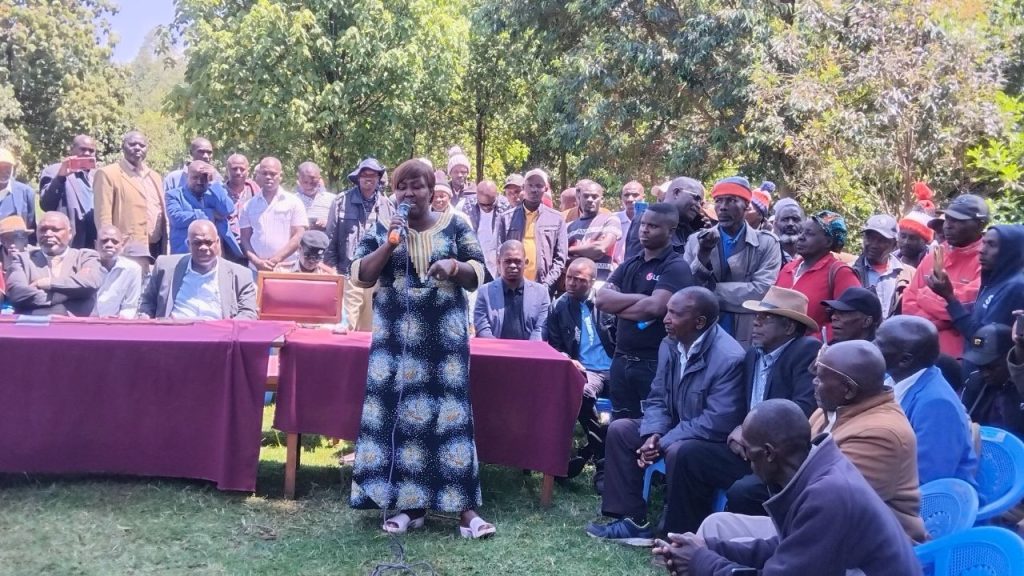
Hundreds of residents gathered at the Mauche Assistant County Commissioner’s office for a briefing by officers from the national Directorate of Surveys.
Lawrence Ngetich, speaking on behalf of the Director of Surveys, said the teams would pick up where the first phase of forest boundary demarcation ended. The work will include placing additional markers near farms bordering the forest cutline.
“We have done a lot before in the first exercise, especially the pillars we put here. What we are now going to do is complete the remaining demarcation closer to farms so that individuals can accurately know the forest boundary on their farms,” Ngetich said.
He said surveyors would also review earlier maps and use overlays to align survey records with the 35,301.01 hectares recognized by the court.
The exercise follows a Sept. 30, 2024, Environment and Land Court judgment in Tonui v Kenya Forest Service and three others. Justice J.M. Mutungi held that the government had legally excised 35,301.01 hectares from Eastern Mau through Legal Notice No. 142 of Oct. 8, 2001.
The court directed the government to establish and clearly mark the forest boundary within 12 months by placing visible beacons in the Nessuit, Mariashoni, Sururu, Likia, Teret and Sigotik settlement schemes.
It also ordered the government to verify and authenticate land allottees and issue titles to those who had not received them. People found to have encroached beyond the established boundary were ordered to leave, failing which the Kenya Forest Service could evict them in accordance with the Land Act.
The court’s 12-month deadline expired on September 30, 2025.
Surveyors carried out the first phase between April 21 and May 18 last year, putting up 75 boundary pillars between Sururu and Baraget. The ministry said rough terrain, bad weather, poor satellite coverage, inadequate funding and transport shortages had slowed the work.
Under the deployment announced on Wednesday, one team will cover Sururu and Likia, while a second will work in Teret and Sigotik. A third team will cover Nessuit and Mariashoni, and a fourth will work in Baraget and Kapsita.
Baraget and Kapsita were included in the field deployment, although they are not among the six settlement schemes specifically named in the 2024 court orders. Officials did not explain the difference during the briefing.
Njoro MP Charity Kathambi Chepkwony welcomed the deployment of additional surveyors, saying residents had lived with uncertainty over land boundaries and ownership for years.
“I want to say that this will be the last time we are having a meeting discussing land issues here. The next time we will be meeting would be issuing of titles,” Kathambi said.
She said completing the survey and lifting the caveat affecting land in the area would allow residents to put their properties to commercial use. No official timeline for lifting the caveat or issuing titles was announced at the meeting.
Nessuit MCA Samwel Tonui, the lead petitioner in the court case, said the second phase gave residents hope that the long-running dispute would finally be resolved. He called on the government, including the Environment and Lands ministries and the Directorate of Surveys, to complete the process without further delay.
Mauche MCA Moses Koros and Mariashoni MCA Bernard Langat urged residents to allow surveyors access to their farms and cooperate with the teams throughout the exercise.
Resident Richard Rop welcomed the resumption of the work, saying communities in the affected areas had waited many years for the land and boundary questions to be settled.
About The Author